Weather Radar and Forecasting Solutions
Crucial Supplemental Weather data for Government Agencies
Climavision offers advanced solutions to address the rise in extreme weather events. Our technology assists government agencies, public safety, and emergency management teams in preparing for and responding to natural disasters.
Before and during extreme weather, we provide real-time supplemental weather radar data for decision-making, improving preparedness and response efforts. Following disasters, our insights offer quick access to weather impacts to aid responders in formulating effective strategies.
Ready to See weather threats
on the Horizon?

Apoorva Bajaj
Government Business Development Executive
apoorva.bajaj@climavision.com
+1 502 665 0830
High Resolution Radar Data
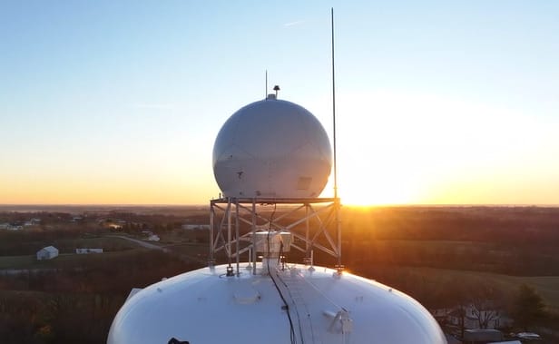
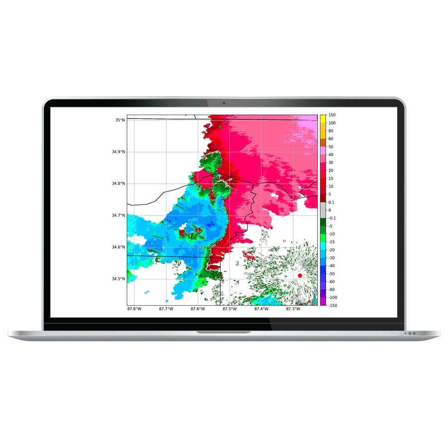
Climavision is installing a high-resolution radar network to supplement the existing National Weather Service NEXRAD network across the nation, siting them in locations that need them the most. Owned and operated by Climavision, the privately-owned network will deliver commercial, best-in-class Radar-As-A-Service (RaaS) products to government agencies at all levels. Our weather radar network delivers complete coverage at critical lower levels – 24 hours a day, seven days a week. The weather radar data, available in several formats and delivery methods, can help you determine the precipitation type and intensity in your location, be it rain droplets, snow, hail, or a mix of everything. It also shows the recent movement of precipitation in the surrounding regions, so you can plan your responses accordingly.
By integrating our weather data with GIS systems, planners in state emergency management agencies and DOTs can proactively mitigate risks. With Climavision, communities can better prepare for and respond to the challenges of an evolving climate.

Climavision Radar Installations as of June 2024
SOLUTION: RADAR AS A SERVICE
Benefits of RAAS
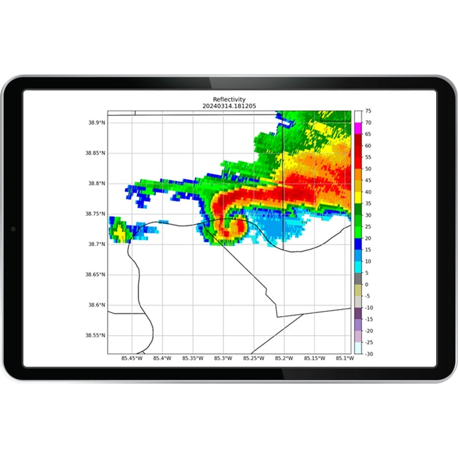
- Mobile friendly, browser based real-time display of local radar products such as reflectivity, velocity to show you rain, snow, hail, and tornadoes
- Immediate access to archived storm data such as hail and tornado signatures and rainfall accumulation to assist in disaster response activities such as dispatch and recovery, forensic analysis, and long-term storm data to support report and proposal writing.
- Low annual data services contract instead of burdening communities with the hassle of a multi-million-dollar radar acquisition
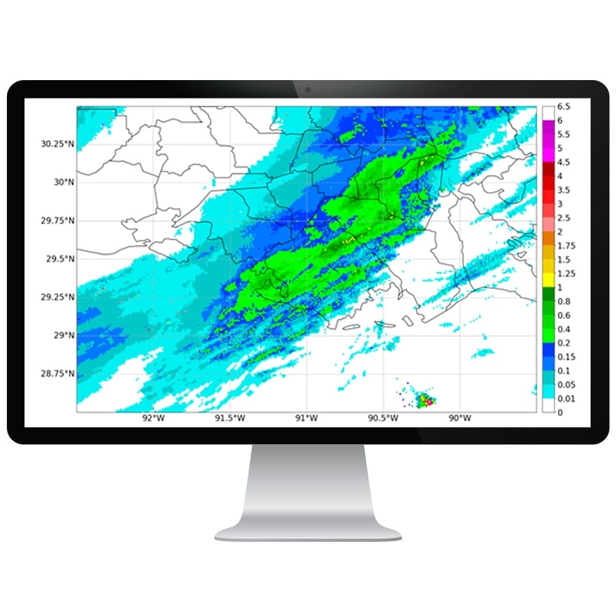
Quantitative Precipitation Estimation
Climavision’s Quantitative Precipitation Estimation (QPE) is a radar data derived product that approximates the amount of precipitation that has fallen at a location or across a region. We combine Multi-Radar Multi-Sensor (MRMS) radar mosaic data with Climavision’s proprietary radar network for a dense observation of rainfall. QPE is capable of providing instantaneous rain rate, as well as various accumulation products that update rapidly.
- Instantaneous QPE Mosaic: updates with most recent radar scan
- 15 Minute QPE Mosaic: updates every 2 minutes
- 1 Hour QPE Mosaic: updates every 2 minutes
- 24 Hour QPE Mosaic: updates every hour at the top of the hour
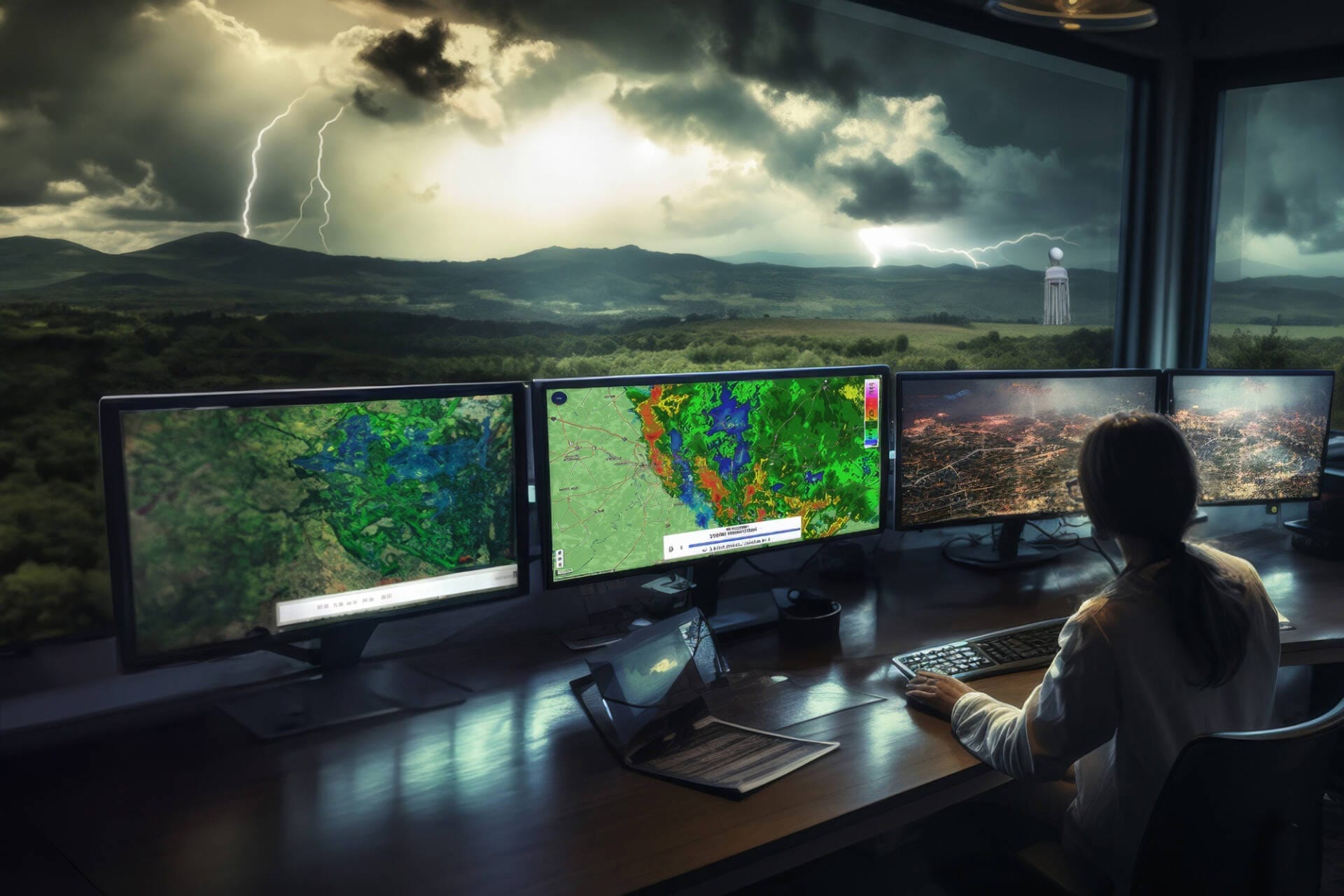
VISUAL AND INTERACTIVE WEATHER RADAR DATA VIEWER
GIVING YOU THE ABILITY TO RESPOND RATHER THAN REACT
We deliver the information you need, in formats you need, faster through our customizable weather radar data viewer, API or Esri, to help you make informed decisions. Our cloud-based data warehousing and high-performance processing support high-resolution coverage in real-time.
- High Resolution weather data viewer, API, or Esri
- GR2, GeoTIFF, NetCDF
- Customizable data delivery solutions
- Intuitive design