Accurate Weather Radar Services | Radar as a Service
Critical Radar Data without
the Capital Investment
Gain invaluable real-time weather information with our supplemental network of high-resolution radars. With Climavision’s accurate weather radar data services, you can now confidently prepare for and respond to extreme weather events.
Power Your Business With
Real-time Weather Radar Data
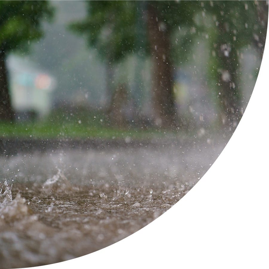
Severe weather events have become more common than ever before. The unpredictable nature of floods, thunderstorms, sleet, or freezing rain events puts people and businesses at risk. Given these circumstances, timely forecasts and real-time, accurate weather data have never been more critical.
That said, lower-level atmospheric surveillance is important for meteorologists to forecast severe weather conditions. While the U.S.A. possesses one of the best radar networks in the world, there are still gaps that need to be filled. Due to the earth’s curvature, a significant portion of the lower levels of the atmosphere are not being observed effectively, leading to missed warnings and vital weather updates.
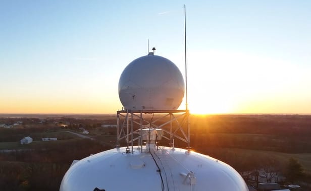
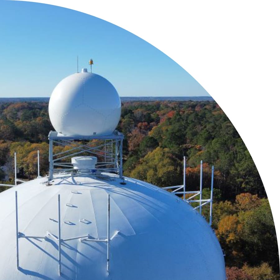
We’re filling these observation gaps with our advanced weather radar systems – the first-of-its-kind, supplemental radar network that provides access to real-time, streaming radar data. In addition to that, our weather radar network delivers complete coverage at critical lower levels – 24 hours a day, seven days a week. The best part? Our radar network is accessible as a simple subscription service, regardless of your location. The weather radar map can help you determine the precipitation type and intensity in your location, be it rain droplets, snow, hail, or a mix of everything. It also shows the recent movement of precipitation in the surrounding regions, so you can plan your responses accordingly.

Climavision Radar Network As Of June 2024
PRODUCT Features
- Nationwide supplemental network of low-altitude gap-filling dual-pol weather radars
- 10X Higher resolution, 20-30 second updates on storm development
- Solid-state transmission and pulse compression techniques for highest radar sensitivity
- Comprehensive radar algorithms for weather detection, estimation, and forecasts
- No 5G signal interference
PRODUCT Benefits
- Improved severe weather insights with no high-priced capital outlay
- Ability to plan proactive protocols and respond accordingly
- Real-time data that folds effortlessly into existing alerting workflows
- Archive observations for historical records
- Capture a smooth blend of RaaS with NEXRAD data
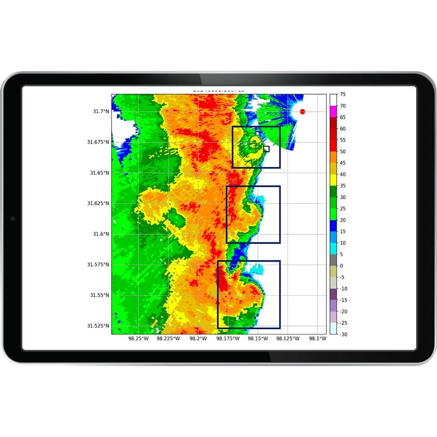
FILLING THE WEATHER RADAR GAPS
THE FUTURE OF WEATHER RADAR TODAY
Our overlapping high-resolution radars sweep out to capture lower atmospheric activity. The dual-polarization technology distinguishes phenomena critical for making accurate danger assessments.
Low level atmospheric insights:
- Comprehensive Coverage Below 4,000 feet
- Accurate rainfall estimates
- Detects types of precipitation (i.e., rain, snow, freezing rain)
- Identifies debris fields of an approaching tornado
- Identifies non-meteorological activity, including fire, bugs, dust, etc.
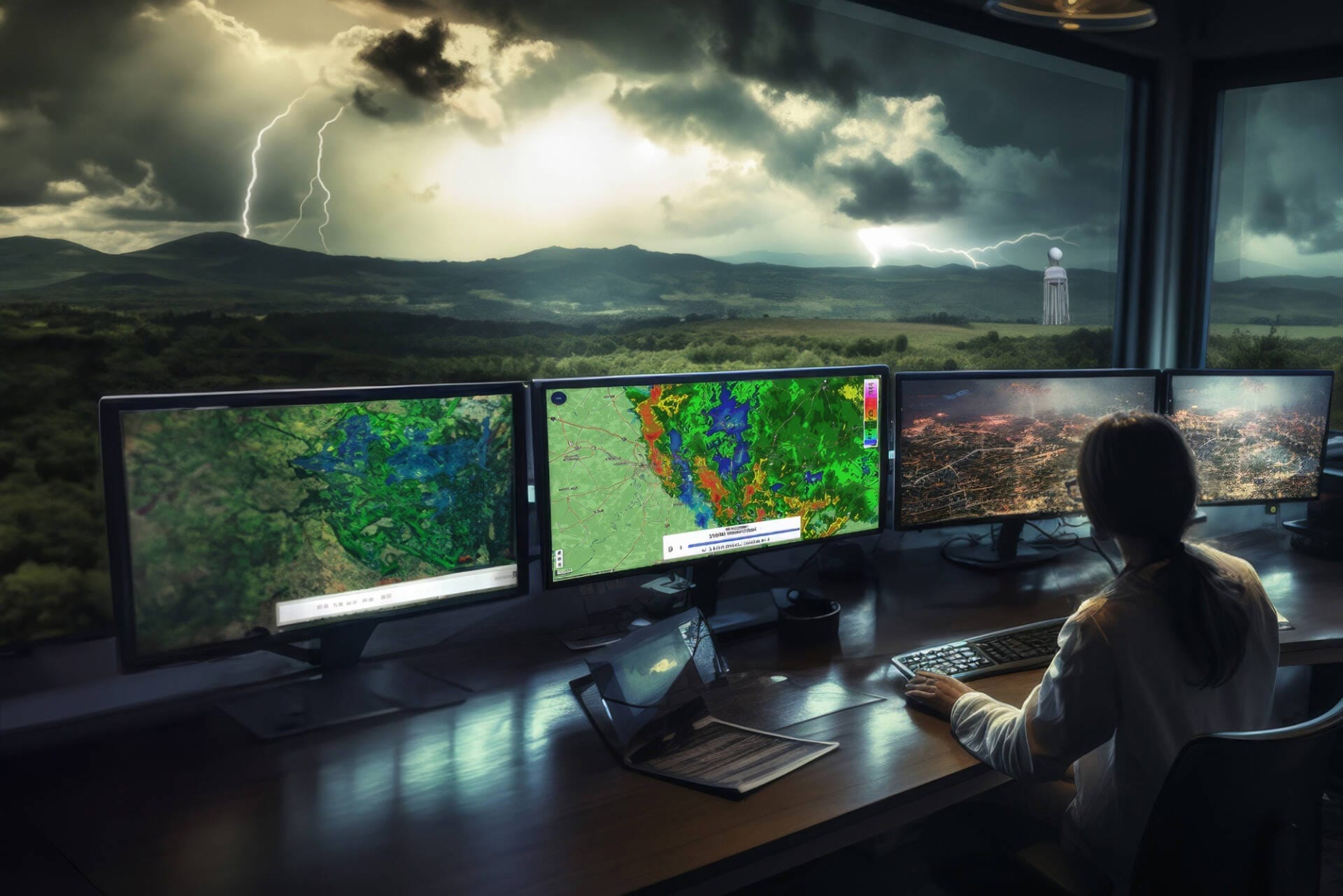
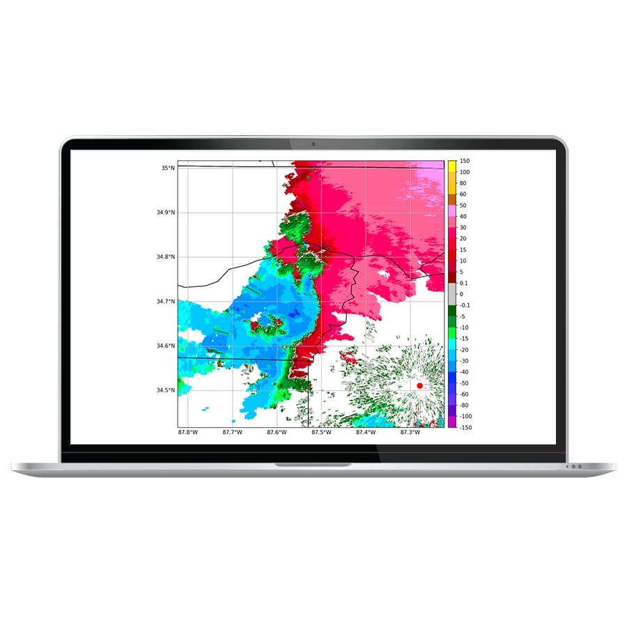
VISUAL AND INTERACTIVE WEATHER RADAR DATA VIEWER
GIVING YOU THE ABILITY TO RESPOND RATHER THAN REACT
We deliver the information you need faster through a responsive desktop and mobile application, ESRI integration, or API. We can also integrate with existing dashboards and platforms. Our cloud-based data warehousing and high-performance processing support high-resolution coverage in real-time.
- Desktop and sleek, responsive mobile application
- Customizable data delivery (such as through ESRI or other platforms)
- Available in level II files, netcdf and geotiff formats
- Archived data
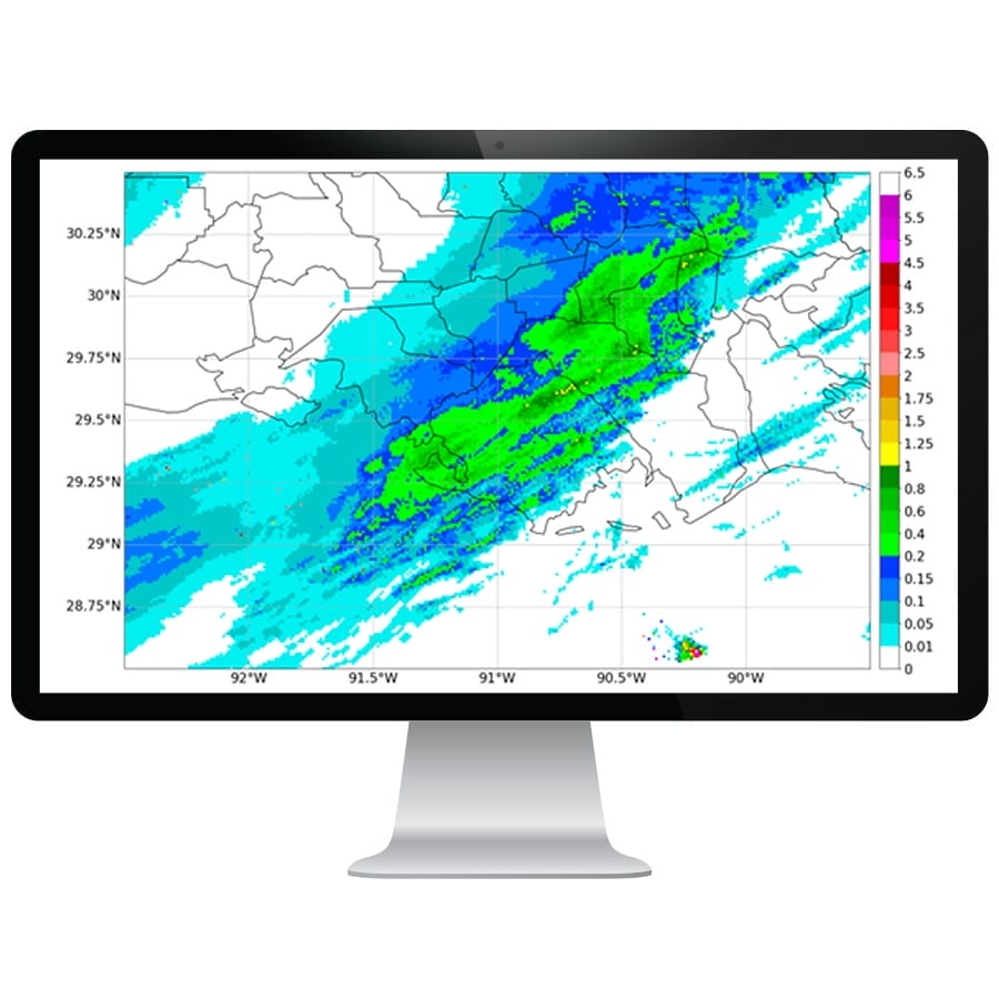
Quantitative Precipitation Estimation
Climavision’s Quantitative Precipitation Estimation (QPE) is a radar data derived product that approximates the amount of precipitation that has fallen at a location or across a region. We combine Multi-Radar Multi-Sensor (MRMS) radar mosaic data with Climavision’s proprietary radar network for a dense observation of rainfall. QPE is capable of providing instantaneous rain rate, as well as various accumulation products that update rapidly.
- 1km x 1km grid resolution
- Full US mosaic
- Units are in/hr
- Utilizes data from NWS radar network
- Supplemented with data from the Climavision radar network
- Access in radar data viewer as layers and as NetCDF file delivery
QPE Product variations
Climavision currently offers 4 versions of QPE in varying time ranges to best suit your use case
- Instantaneous QPE Mosaic: updates with most recent radar scan
- 15 Minute QPE Mosaic: updates every 2 minutes
- 1 Hour QPE Mosaic: updates every 2 minutes
- 24 Hour QPE Mosaic: updates every hour at the top of the hour
Climavision’s Gap-filling, X-Band weather radar provides high resolution insight that helps industries, commercial forecasters, and emergency officials better prepare and respond to volatile weather situations.
LEARN MORE ABOUT WEATHER RADARS
What is a Weather Radar? Your Guide to How Radar Works
Weather radar stands as an indispensable tool within meteorology, serving as a pivotal instrument for observing severe weather events and predicting weather patterns. This guide aims to provide a comprehensive understanding of weather radar systems, their functionality, various radar bands, strengths, weaknesses, and their significant role in weather forecasting.
Precise Weather Radar for Unparalleled Accuracy
Our advanced radar network offers powerful insights for accurately tracking dangerous weather and disastrous events, like floods and tornados. While the weather may change in the blink of an eye, our superior radar network offers real-time feeds so you are up to date with the current weather conditions in the areas of interest. In fact, there is no maintenance or extended downtime. You can rest assured that you will receive accurate weather updates you can count on.
WE’RE REVOLUTIONIZING THE WEATHER INDUSTRY
Our extensive weather data and revolutionary, AI-driven climate technologies identify real-time dangers and produce more accurate predictions and forecasting models.
Learn More About What Makes Us Different
Radar Network
First of its kind, supplemental nationwide, high-resolution, dual polarity radar network
Advanced Modeling
Advanced global numeric weather prediction modelling with unprecedented computational capabilities
Observational Datasets
More unique and novel observational datasets assimilated via AI for faster, more accurate forecasts
Technical Expertise
Unparalleled technical expertise across infrastructure, machine learning, cloud and supercomputing