Tornadoes in Focus: How Better Radar Coverage Protects Business and Communities
It’s mid-April, and that means we’re in the heart of tornado season in the U.S.—a time when atmospheric conditions align to produce some of the most intense and fast-moving storms of the year. Tornadoes are among the most terrifying forces of nature—fast-forming, violently destructive, and often unpredictable. With the U.S. experiencing an average of over 1,000 tornadoes each year, and severe weather volatility on the rise, understanding tornadoes—and how we detect them—is more critical than ever. Despite modern advances in forecasting, large gaps in radar coverage still leave millions of Americans vulnerable. Fortunately, new technology is changing that.
Let’s take a closer look at tornado behavior, their growing impact, and how innovations like Climavision’s Radar-as-a-Service (RaaS) are helping protect lives and communities.
In Summary
- Tornado season is peaking, with April and May bringing the highest risk of severe and fast-forming storms across much of the U.S.
- Radar blind spots leave millions vulnerable, especially in rural areas where low-level tornado detection is limited or nonexistent.
- Tornado outbreaks are becoming more clustered and intense, with shifting activity patterns moving east into Dixie Alley.
- Climavision’s Radar-as-a-Service (RaaS) fills critical coverage gaps, doubling tornado detection rates and reducing response times.
- Better radar = better protection for communities, emergency responders, businesses, and infrastructure during high-impact weather events.
Tornado 101: What You Need to Know
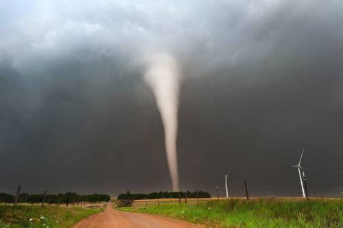
A tornado is a rapidly rotating column of air extending from a thunderstorm to the ground. These funnel-shaped clouds can pack wind speeds over 300 miles per hour and cut paths more than a mile wide and 50 miles long. While most tornadoes travel around 30 mph, some can be nearly stationary or rush forward at 70 mph.
Tornadoes are most common in the U.S., particularly across “Tornado Alley” in the Central Plains—but that’s changing (more on that below). They can form with little notice and sometimes under seemingly calm skies. While 77% of U.S. tornadoes are considered weak (EF0–EF1), even these can cause significant damage. And the rare EF5s? Those can completely flatten buildings and send vehicles flying.
The Devastating Impacts of Tornadoes
Though their paths may be narrow, tornadoes are brutal in their intensity. In minutes, they can:
- Tear apart homes and businesses
- Flip cars, trucks, and trains
- Strip trees bare or rip them out by the roots
- Cause chemical spills, sewer leaks, and air contamination
- Lead to long-term environmental hazards
Beyond the physical destruction, tornadoes have a massive human and economic toll. They cause roughly 70 fatalities and 1,500 injuries per year in the U.S., along with billions in financial losses. Take the 2011 Joplin, Missouri tornado—it caused 161 deaths, injured more than 1,000 people, and cost $2.8 billion in damage.
And indirect losses—from lost work hours to rerouted transportation—can ripple through communities for months after the skies clear.
Tornado Frequency is Shifting — Are We Ready?
Historically, the Great Plains have taken the brunt of tornado activity. But new research shows the frequency is shifting eastward, toward the Southeast’s “Dixie Alley.” Areas like Mississippi, Alabama, and Tennessee are now seeing more frequent and clustered tornado outbreaks.
Interestingly, the total number of tornadoes per year remains relatively stable—but they’re becoming more concentrated. We’re seeing fewer “tornado days” and more days with massive outbreaks. That clustering means a single storm system can bring widespread devastation across multiple states.
This shift has major implications for preparedness—especially in regions that haven’t historically faced frequent tornadoes and may lack the infrastructure or radar systems to detect them early.
Radar Gaps Put Lives at Risk
You might think we have tornado detection figured out. But radar coverage in the U.S. is far from complete—especially at the low levels of the atmosphere where tornadoes form.
Why? Traditional weather radar (like NEXRAD) sits on a curved Earth and beams that climb higher with distance from the radar site. That means the farther away a location is, the higher in the atmosphere the radar scans—leaving the crucial lower levels unseen.
According to NOAA’s Storm Prediction Center, tornado warning performance drops significantly when you move more than 50 nautical miles from a radar site. That’s a problem, considering 130 million Americans live in radar “gaps”—many in rural, high-risk areas. These blind spots can delay warnings and put entire communities at greater risk.

How Climavision’s RaaS is Transforming Tornado Detection
Climavision is working to close these gaps with our Radar-as-a-Service (RaaS) solution—a proprietary network of supplemental, low-level weather radars designed to detect tornadoes and other severe weather in real time.
Here’s what makes RaaS a game-changer:
- Low-Level Coverage: Our radars target atmospheric layers under 1 km above ground—precisely where tornadoes and dangerous winds form.
- Expanded Reach: With dozens of operational sites and 170+ planned, our network fills in blind spots across rural America and underserved regions.
- Scientific Rigor: Our system is backed by radar science experts, who develop and refine radar signal processing for enhanced accuracy.
- Proven Improvement: With our network, radar-detected tornadoes are expected to increase from 30% to 60%. We also estimate that 30% of tornado-related fatalities happen in areas without low-level radar—gaps we’re actively filling.
Camden, TN Tornado Case Study
A tornado struck Camden, TN, but was undetected by the nearest NEXRAD radars due to high beam heights (~3.6k ft & ~5k ft AGL).
The Climavision Impact:
- Climavision’s radar captured the tornado at near-ground level, detecting the hook echo, velocity couplet, and Tornado Debris Signature (TDS).
- Provided clear, real-time confirmation of the tornado. Such insight enables faster response and improved broadcast coverage.
What This Means for Emergency Response and Business Continuity
Better radar means more than better science—it means faster warnings, safer evacuations, and more informed decisions. Whether you’re an emergency manager, city planner, utility operator, or business owner, more accurate and timely data helps:
- Save lives through quicker alerts
- Reduce downtime and infrastructure damage
- Improve insurance assessments and loss prevention
- Optimize logistics, routing, and facility protection during severe weather
It’s Time to Upgrade How We See the Storm
Tornadoes may be unstoppable, but the devastation they leave behind doesn’t have to be. With better detection comes better preparation. As tornado behavior shifts and intensifies, our radar technology needs to evolve too.
Climavision’s RaaS is helping close the gaps—literally—by delivering the low-level radar data that saves lives and supports stronger communities.
Contact us today to learn how our radar network can help protect your organization or municipality from the next storm on the horizon.


