SUNY Oswego Students Demonstrate the Benefit of Supplemental Weather Radar in Research Project
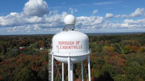
Every year, lake effect snow threatens travel on Interstate 90 in New York due to the transportation corridor’s proximity to Lake Erie. In previous years, the lake effect snow was almost impossible to measure due to a gap in the weather radar network, making preparation and response difficult. This winter, a weather radar installed by Climavision in Pleasantville, Pennsylvania provided high-resolution data over the area.
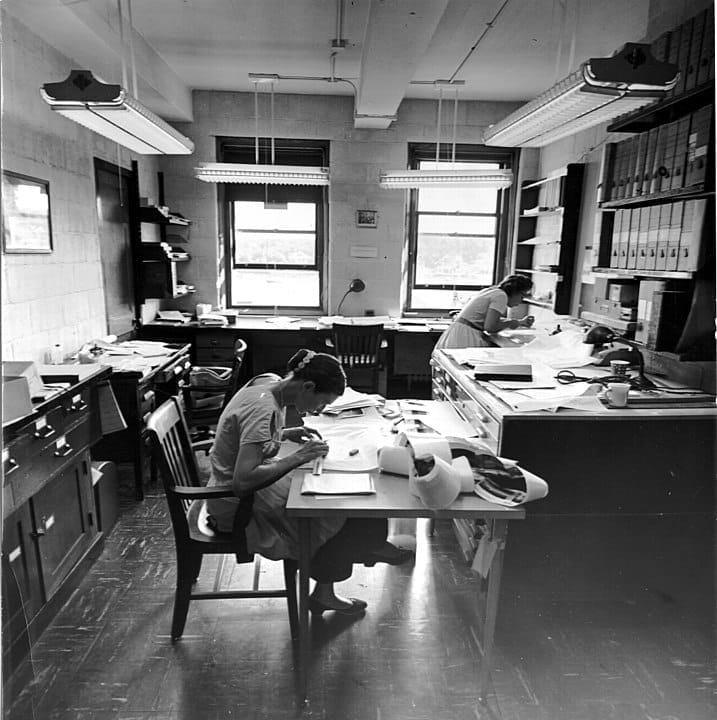
A small group of student researchers at the State University of New York (SUNY) are using the Climavision radar data from our Pleasantville radar to determine the impact of supplemental weather radar coverage on lake effect weather observations and forecasts. These students are collecting and analyzing data to plot and present to many different groups, including New York state agencies. So far, they have found added accuracy when combining supplemental radar data with the existing National Weather Service radar data.
In Summary:
- Two senior students, Thomas White and Zoe Bush, are leading the effort to show the benefits of supplemental weather radar data.
- Thomas and Zoe are working hands-on with new, X-band radar datasets and presenting their findings to various groups, furthering their educational experiences as they look to graduate school.
- Supplemental weather radar data correlates closely with the ground truth when it comes to precipitation types and accumulations.
Project Overview:
Students at SUNY Oswego’s campus are getting a hands-on look at the benefits of supplemental weather radar data. The student research group led by Dr. Scott Steiger analyzes how additional, high-resolution weather radar coverage can benefit the university and state, particularly when it comes to snowfall and mixed precipitation. Two senior students, Thomas White and Zoe Bush, took on this project to wrap up their senior year in hopes of conveying the benefit of supplemental radar coverage to many different organizations across the Empire State. They are using data from Climavision’s Pleasantville, PA radar in their study.

This research project began with an introduction between Climavision and SUNY Oswego’s Lake Effect Storm Prediction and Research Center (LESPaRC). LESPaRC connects SUNY Oswego to other universities and forecasting programs, like the National Weather Service and New York’s Department of Transportation, allowing students to work with real-time weather observations and forecasts. Participating students then tie their findings into client work. As the name suggests, the research department often forecasts and reports on lake-effect weather, a relatively common occurrence in the Great Lakes region of the United States.
Zoe Bush and Thomas White, the students leading this effort, are fourth-year seniors majoring in meteorology with minors in mathematics. Both researchers hope to use their degree and experience to continue their educations at Texas A&M University and the University of North Dakota, respectively. When asked about the benefit of hands-on research to the student experience, Dr. Steiger, advisor for LESPaRC, said, “It gives a student ownership in the creativity involved in research. They are truly contributing to the advancement of our field!”
Meet the Students:
Thomas and Zoe have been hard at work analyzing data and developing plots to represent their findings. As seniors with plans to further their education, they have a lot on their plates.
“The most difficult aspects of this project have been finding the time to download radar files and create unique, compelling figures that effectively convey the importance of supplemental weather radars. As a senior in college, I’m balancing multiple responsibilities, including helping run several clubs, attending classes, and completing two theses,” said Thomas White, when asked about the challenges of this project.
Despite the work required to analyze and compare data, as well as create presentations to showcase their findings, Thomas and Zoe are motivated to complete this study.
Zoe shared what led her to take on this project, “The main motivation for taking on this project is the possibility of Oswego, NY having a Climavision Radar nearby. Being able to see how the Pleasantville Radar benefits the area, especially when it comes to lake-effect snow, would indicate if the Climavision radar could help us improve our forecasting.”
The researchers have already made one presentation to business leaders and professionals, and will continue presenting to various groups as they develop their findings.
The Results:
While the research project is still in progress, some results have been found already. Thomas expressed the benefit he has seen in supplemental radar coverage, “Lake-effect snow, which often produces hazardous snowfall rates, can occur below 2 km in altitude. Supplemental radar coverage at these lower altitudes enhances the accuracy of precipitation measurements. Additionally, dual-polarized variables like correlation coefficient and differential reflectivity offer valuable insights, helping forecasters provide more precise and reliable snowfall forecasts or warnings.”
The two students are mainly focused on the impact of enhanced coverage on detecting snowfall and mixed precipitation – two areas of precipitation detection where the Pleasantville X-band radar system excels. So far, they have found enhanced measuring capabilities when using a combination of NEXRAD weather radars and supplemental measurements. The more accurate measurements correlate closely with the ground-truth. The research group hopes to add supplemental radar data to their typical radar datasets, expressing it can improve the ability to describe impacts and issue better forecasts for many clients, including the New York State Department of Transportation.
Their results match reports from supplemental radars across the country. Such radars have aided in detecting severe wind gusts, tornadoes, snow squalls, and more that would have gone undetected without additional radar data.

What is Supplemental Weather Radar Coverage?
Weather radars shoot a beam of energy out in a straight line away from the radar. This beam of energy hits particles in the atmosphere and reflects back to the radar where the returning energy is received and interpreted as precipitation. Because the earth is curved and the beam travels in a straight line, the farther the beam is from the radar, the higher it is above the earth’s surface. As a result, there are areas where the radar beam is detecting weather far above the ground and does not accurately report what is affecting people. When the beam is too high in the atmosphere, the area under the beam is considered a radar gap. These radar gaps begin around 60 miles away from the location of a radar. This distance can change based on topography.
At Climavision, we install weather radars in these gap areas, providing data that supplements the existing National Weather Service radar network. The added radars provide what is called supplemental weather radar coverage. To learn more about radar gaps, and how they may affect you, read our blog post: Are Voids in Radar Coverage Leaving You Blind?
Climavision’s Involvement:
At Climavision, we are both excited and proud to contribute to partner with SUNY Oswego on this project. We provide supplemental weather radar data from our Pleasantville, PA radar to the student researchers, allowing them to analyze the benefit of gap-filling radars and form conclusions on the impact of such data across many different public organizations.
Stationed just 47 miles from Lake Erie’s coast, our Pleasantville radar is in a prime position to detect lake effect weather. With a 60-mile coverage radius, the radar can report both what is impacting the land and what may be forming just offshore. Already, the Pleasantville radar has detected lake effect snow that nearby NEXRAD systems missed, providing necessary information and helping local individuals and organizations make informed weather decisions.
We have plans for two supplemental radars in New York, adding radar coverage to areas around Lake Ontario and the New York and Vermont border. Both of these radars will be in prime position to detect winter and lake-effect weather. The results from this study will help us determine the exact locations for the future systems and engage the proper state and local stakeholders – such as transportation and public safety officials.
Get Involved
If you are interested in using Climavision radar data – either for research or operations – fill out the form below. We would love to provide radar data for your study! With 29 radars installed across the United States so far, and more to come, there is plenty of data to add to your research efforts. If we do not currently have a radar installed near you, we may be there soon!